Overview
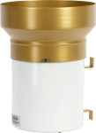
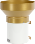
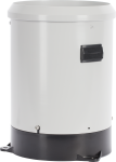
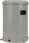
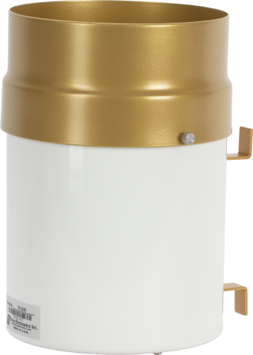
The TE525, manufactured by Texas Electronics, has a 6 in. orifice and measures rainfall in 0.01 in. increments. It is compatible with all Campbell Scientific data loggers, and it is widely used in environmental monitoring applications.
Read MoreBenefits and Features
- Accuracy is ±1 percent at rates up to 1 in./hr
- Compatible with most Campbell Scientific data loggers
- High precision—tips at 0.01-in. increments
Images

Detailed Description
The TE525 funnels precipitation into a bucket mechanism that tips when filled to its calibrated level. A magnet attached to the tipping mechanism actuates a switch as the bucket tips. The momentary switch closure is counted by the pulse-counting circuitry of our data loggers.
Compatibility
Note: The following shows notable compatibility information. It is not a comprehensive list of all compatible or incompatible products.
Data Loggers
| Product | Compatible | Note |
|---|---|---|
| CR1000 (retired) | ||
| CR1000X (retired) | ||
| CR300 (retired) | ||
| CR3000 (retired) | ||
| CR310 | ||
| CR350 | ||
| CR6 | ||
| CR800 (retired) | ||
| CR850 (retired) |
Additional Compatibility Information
Mounting
The TE525 rain gage mounts to a CM300-series Mounting Pole or a user-supplied 1.5-in. IPS pole. Several pedestal options are available to secure a CM300-series pole to the ground (see Ordering Information). Accurate measurements require the gage to be level.
Snowfall Adapter
The TE525 cannot be directly used with our CS705 rainfall adapter. However, the CS705 is compatible with the TE525WS, and the TE525 can be converted to a TE525WS by returning it to Campbell Scientific (requires an RMA).
Wind Screen
Campbell Scientific offers the 260-953 Wind Screen to help minimize the effect of wind on the rain measurements. This wind screen consists of 32 leaves that hang freely and swing as the wind moves past them.
Specifications
| Sensor Type | Tipping bucket with magnetic reed switch |
| Material | Anodized aluminum |
| Operating Temperature Range | 0° to 50°C |
| Resolution | 1 tip |
| Volume per Tip | 4.73 ml/tip (0.16 fl. oz/tip) |
| Rainfall per Tip | 0.254 mm (0.01 in.) |
| Measurement Uncertainty | 1.0% up to 50 mm/h (2 in./h) |
| Cable Type | 2-conductor shielded |
| Orifice Diameter | 15.4 cm (6.06 in.) |
| Height | 24.1 cm (9.5 in.) |
| Cable Weight | 0.1 kg (0.2 lb) per 3.05 m (10 ft) length |
| Tipping Bucket Weight | 0.9 kg (2.0 lb) |
Documents
Videos & Tutorials
Frequently Asked Questions
Number of FAQs related to TE525-L: 15
Expand AllCollapse All
-
Replacement screens are listed in the Replacement Parts section of TE525-L Ordering Information page.
Replacement funnels can be ordered by contacting Campbell Scientific.
-
The accuracy of the TE525-L diminishes as rainfall intensity increases (see the Accuracy specification) because at higher intensities, rain will keep pouring into the tipping mechanism as it is tipping, causing missed tips. The maximum listed intensity in the specifications is 2 to 3 in./hr, which would give an accuracy of +0%, -5%.
-
The TE525-L and TE525WS-L have a 0.01 in. tip.
-
The CS705 Tipping Bucket Snowfall Adapter cannot be used directly with the TE525-L or TE525MM-L because of the funnel size. To make the rain gages compatible, they can either be sent to Campbell Scientific to be converted to a TE525WS-L, or an 8 inch funnel can be installed. If the funnel is used, see the instruction manual for the appropriate multipliers, as they will change.
-
A TE525-L can be converted to a TE525MM-L and vice versa because the inner tipping mechanisms are the same. To convert a TE525-L or TE525MM-L to a TE525WS-L, the rain gage must be sent in to Campbell Scientific to change the tipping mechanism. If an 8 inch funnel is used on a TE525-L or TE525MM-L without changing the tipping mechanism, the multipliers for the rain measurement will change. For information about these multipliers, see the TE525 Instruction Manual.
-
The 260-953 Alter-type rain gage wind screen consists of 32 heavy metal leaves that hang freely and swing as the wind moves past them. The swinging leaves act as a wind damper and help minimize the effect of wind on the rain measurements without adding additional turbulence.
-
Not enough tips or too many tips.
-
The most common errors are either that the rain gage appears to have drifted out of calibration or that the tips are not being correctly recorded by the data logger.
-
The information included on a calibration sheet differs with each sensor. For some sensors, the sheet contains coefficients necessary to program a data logger. For other sensors, the calibration sheet is a pass/fail report.
-
Most Campbell Scientific sensors are available as an –L, which indicates a user-specified cable length. If a sensor is listed as an –LX model (where “X” is some other character), that sensor’s cable has a user-specified length, but it terminates with a specific connector for a unique system:
- An –LC model has a user-specified cable length for connection to an ET107, CS110, or retired Metdata1.
- An –LQ model has a user-specified cable length for connection to a RAWS-P weather station.
If a sensor does not have an –L or other –LX designation after the main model number, the sensor has a set cable length. The cable length is listed at the end of the Description field in the product’s Ordering information. For example, the 034B-ET model has a description of “Met One Wind Set for ET Station, 67 inch Cable.” Products with a set cable length terminate, as a default, with pigtails.
If a cable terminates with a special connector for a unique system, the end of the model number designates which system. For example, the 034B-ET model designates the sensor as a 034B for an ET107 system.
- –ET models terminate with the connector for an ET107 weather station.
- –ETM models terminate with the connector for an ET107 weather station, but they also include a special system mounting, which is often convenient when purchasing a replacement part.
- –QD models terminate with the connector for a RAWS-F Quick Deployment Station.
- –PW models terminate with the connector for a PWENC or pre-wired system.
Case Studies
In 2022, as Hurricane Fiona unleashed relentless rain on Puerto Rico, the Puerto Rico Landslide......read more
Overview In May 2019, the Government of Zambia embarked on the Climate Adaptation Water and Energy......read more
In 2013, a sinkhole appeared next to a historic home in southern Louisiana. Over the......read more
Scientists and land-use managers have long recognized the importance of forest lands for their role......read more
Networks using the ALERT protocol are designed to give immediate access to data that indicates......read more
The Delaware Environmental Observing System (DEOS) is a real-time system dedicated to monitoring environmental conditions......read more
The Austin College Weather Station (ACWX) is located on Austin College's Sneed Environmental Research Area,......read more
North Dakota agriculture ranks high in the nation’s crop production: No. 1 in durum and......read more
Articles and Press Releases
Newsletter Articles
Privacy Policy Update
We've updated our privacy policy. Learn More
Cookie Consent
Update your cookie preferences. Update Cookie Preferences
